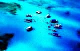
Paxi is the smallest of the seven major islands in the Ionian chain, with an area of 25.32 square kilometres (length 8 km., breadth 4 km). The island lies seven nautical miles to the south of Corfu, quite close to the coast of Epirus: the channel between Paxi and Parga is only 12 nautical miles wide. There are ferry departures to Corfu town and Lefkimmi, and also to Patra, Igoumenitsa, Amfilochia and Preveza, while during the summer month's launches ply back and forth to Parga. The population of Paxi is 2,400 - most of them employed in the cultivation of the olive crop and in fishing. Tourism is not particularly highly developed, and Paxi continues to be an ideal place for those who look forward to quiet holidays far from the bustle of the popular resorts.
Paxi is an island of great natural beauty; its dense covering of pines, olives and vines, its deeply indented coastline, its steep rocky cliffs and its sea-caves combine to produce a landscape of idyllic charm. The interior of the island is relatively flat - the highest 'peak', Agios (Agios (Ayios)) Isavros, is only 217 metres above sea level - making it ideal for walking or cycling. Walkers will find numerous paths leading down to isolated beaches. The road network is well-organised and buses run to most of the villages.
The 'capital' of Paxi, and its harbour, is Gaios, a quaint little town of 1,300 inhabitants whose houses are in the style typical of the Ionian Islands. In the entrance to the harbour are two verdant islets, Agios (Ayios) Nikolaos and Panayia, which provide natural protection against rough weather and give Gaios a magical atmosphere. On Agios (Ayios) Nikolaos are the remains of a Venetian castle (1423), while on Panayia is a monastery dedicated to Our Lady. On Her feast each year (15 August), the villagers carry her icon out into the bay on boats and there is a banquet at which all are welcome. Launches run from Gaios to these two islets, and also to Mongonisi and Kaltsonisi, two more uninhabited scraps of rock to the south of Paxi.
Further south is the second largest village, Ozias, a seaside settlement of 250 inhabitants standing on a naturally amphitheatrical site. Ozias is known for its medicinal springs and for the caves to be found around its little harbour. At Porta are the remains of an Early Christian basilica. A little bridge leads across to the nearby islet of Mongonisi, which can also be reached by boat. Most of the tourist development of Paxi is centred on Longos, 5.5 km. north of Gaios, a typically "Ionian" village set amid pine trees which run right down to the water's edge. On the fine beaches nearby are facilities for water-skiing, canoeing and Para kiting, while fresh fish is almost always available in the little taverns. On the north side of the island is Lakka, a holiday community set amid dense vegetation at the head of a bay also called Lakka. Along the coast at Lakka are numerous sea caves, which can be visited by boat. The Ipapanti cave, according to the local people, communicates underground with the church of the Presentation of Our Lady in Lakka itself.
Antipaxi is a still tinier island, lying three nautical miles south of Paxi. It has an area of five square kilometres and a population of about 120. There are few villages, but the island is covered with orchards, most of which belong to people from Paxi. Like Paxi, Antipaxi is densely-wooded, with clean sandy beaches and numerous caves. The nearby islets of Exolitharo and Daskalio can be visited from Antipaxi by boat. The seas around the islands are ideal for spear fishing, and in fact most of the fish consumed on Corfu comes from Paxi and Antipaxi. Little is known about the ancient history of these islands, and very few monuments have survived down to the present day. The written sources tell us that one of the sea-battles between the Corfiots and the pirates of Illyria took place outside the mouth of the Antipaxi channel; the Corfiot defeat in this conflict led to the surrender of the island, in 229 BC, and gave the Romans a pretext for intervening in the area. During the centuries which followed, the history of Paxi was largely the same as that of Corfu, and it was occupied, successively, by the Angevins, the Venetians, the French and the British. Since 1814 it has belonged administratively to the Ionian Islands, and today it is part of the Prefecture of Corfu.
To the north-west of Corfu, at distances of between 10 and 14 miles from its coast, lie a group of islands called the Diapontia which are the most westerly territory of Greece, situated where the Ionian Sea becomes the Adriatic. The largest of the islands are Mathraki, Ereikousa and Othoni, little Greek paradises where time seems to have come to a nearhalt and where life flows slowly and peacefully by. All three are verdant, with olives and cypresses as the commonest trees. The very few inhabitants of the islands are fishermen, farmers and shepherds. Visitors are an even rarer sight, and this has done much to preserve the authenticity of the islands. In the summer months, caiques and launches ply to and from the islands, operating out of the harbours along the north coast of Corfu, but in the winter such sailings are few and far between and the Diapontia islands return to their isolation. Little is known of the ancient history of the islands, and such information as we have comes from the written sources: the poet Lycophron (320-250 BC), the historian Pliny (23-79 AD), and the lexicographer Hesychius (fifth century AD). They seem to have been uninhabited in Byzantine times, and it was not until the Venetians ruled on Corfu that fresh settlers arrived, from Paxi and Epirus. During the period of the British protectorate, the Diapontia were places of exile for those who advocated the unification of the Ionian Islands with the rest of Greece. After unification actually took place in I864, the island's communities were formed into the Municipality of Diapontia, whose chief settlement is Ammos on Othoni. Today, each island is a separate administrative entity of its own, and there are some 600 permanent residents.
Mathraki is three nautical miles from the coast of Corfu, the closest point to it being the beach of Arillas.It has an area of 3.5 square kilometres and around 140 inhabitants, who are employed in fishing and harvesting the olives of the island. In earlier times, this was an island of sailors, owning some 30 sailing ships, but the dwindling population brought sea-faring activities to an end.
The medical and educational needs of the two villages - Ano and Kato Mathraki - are met by a rural doctor's post and by a primary school which rarely has more than seven pupils on its roll. The islanders are inter-related and take part all together in the events of community life, retaining intact all the customs and traditions of the island. They are notable for their friendly and hospitable attitude towards visitors, though tourists are few and rarely stay long, given that there is very little tourist accommodation. East of Mathraki is the uninhabited islet of Diapolo.
Ereikousa is 4.5 nautical miles from Sidari, which it greatly resembles in terms of terrain. It has an area of six square kilometres and is the most populous of all the islets, with 334 permanent residents. In the centre of the island is the village of Ereikousa, around which lie the beaches of Porto, Fiki and Prangini. The islanders, hospitable and out-going, are farmers and fishermen, while the remittances of emigrants - mostly to America - make a major contribution to the island economy. Ereikousa has a hotel, and there are quite a number of rooms to rent.
Othoni is the westernmost point in Greece, lying 7.5 miles from the north-west coast of Corfu and 43 nautical miles from Cape Otranto in Italy. The island has an area of nine square kilometres and two large villages, Ano and Kato Chorio (Ammos), with about 100 inhabitants. The beach near Ammos, the chief settlement, has both sand and pebbles, while there is a sandy beach at Aspri Ammos.
At Aspri Ammos there is a cave which tradition claims as the home of Calypso; it would seem that in the popular mind Calypso's island, where Odysseus lived for years, was identified with Othoni. Some scholars have even gone to far as to claim that this far-flung island, and not Corfu, was Homer's Scheria, and that the palace of king Alcinous stood here. However, there is no historical evidence to back this assertion. At Kastri there are traces of a Venetian fortress, and we know that a sanatorium for British soldiers operated at Kassimatika from 1814 to 1864. During the nineteenth century, Othoni was an important trading centre, and the islanders owned about 60 sailing ships. However, the population began to emigrate after 1850, with large numbers leaving for the United States, Australia and Germany in the 1960s. Today, such islanders as are left are farmers and fishermen, and a small proportion of their income comes from tourism. There are a few rooms to rent on Othoni, and there is also a rural doctor's post.